Near seasonal values in the low twenties are forecasted in southern Manitoba until next weekend as a
southerly flow draws a milder airmass into the Canadian Prairies. By the weekend, temperatures will be on a
cooling trend as cloud cover and unsettled weather spreads into southern Manitoba, keeping temperatures in
the teens. These cooler conditions are likely to last into the early next week until a rebound in
temperatures occurs mid-week next week.
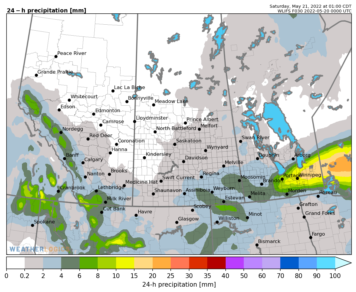
Generally dry weather will return from today until the weekend, under a mix of sun and cloud, resulting in
favourable drying conditions in the fields. The only exception is that a few isolated showers may develop
through western Manitoba and the Parklands during the mid-week in association with afternoon pop-up shower
activity as a slightly unstable airmass will be in place. These showers will be hit or miss, producing
spotty amounts of less than 2 mm on Wednesday and Thursday. The next chance of organized rainfall will
arrive Friday night, lasting through this weekend, as a system develops in the western Canadian Prairies and
spreads an area of rain/thunderstorms eastward into southern Manitoba. Although confidence is high that the
active pattern will return to the province Friday night through the weekend, there are still uncertainties
regarding exact rainfall amounts. That said, rainfall accumulations of up to 10 mm with localized heavier
amounts in thunderstorms are not out of the question across southern Manitoba over the weekend. Another
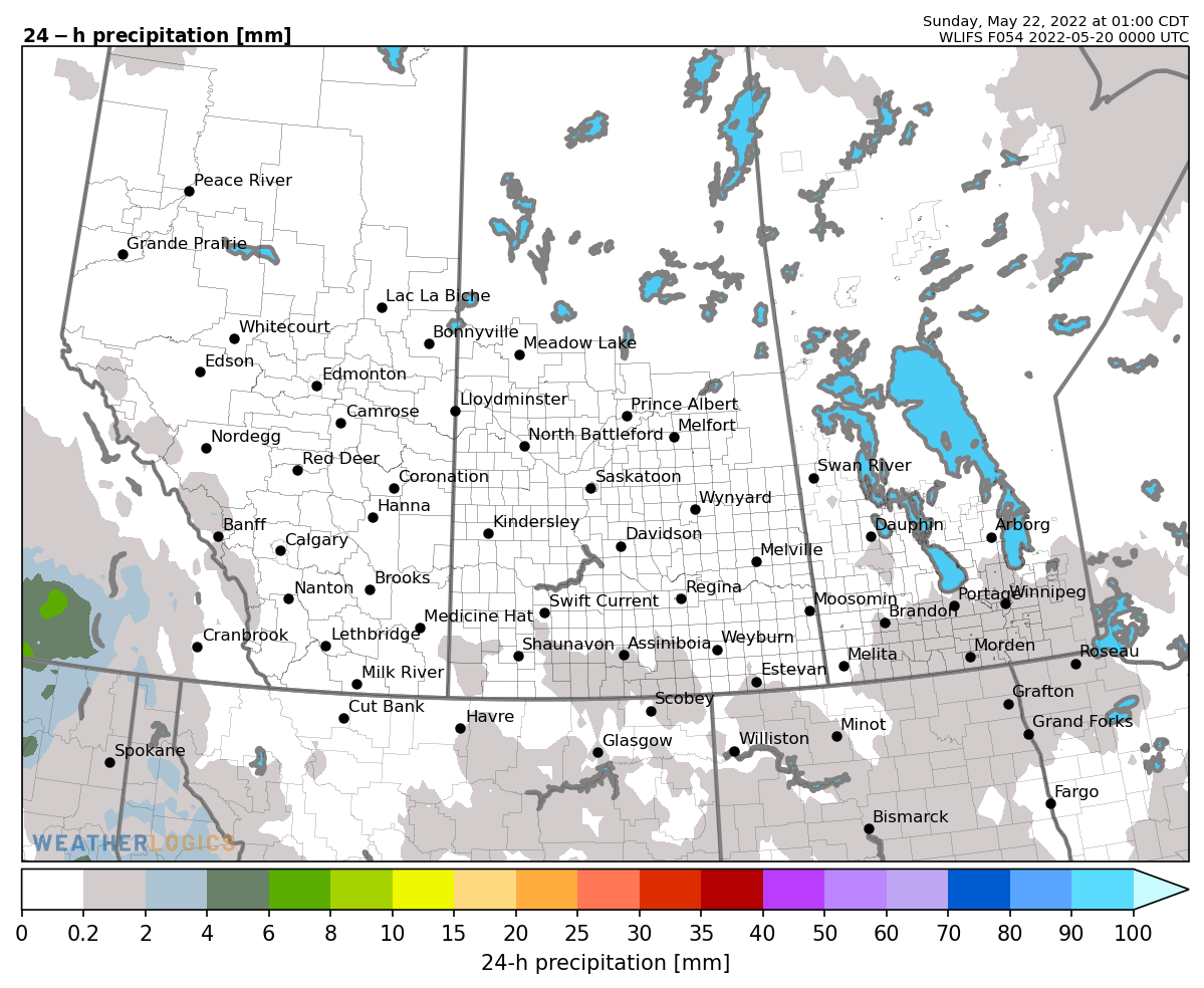
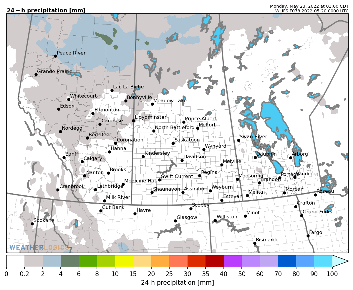
update on rainfall amounts will be provided in tomorrow’s discussion. The system will begin to clear out
early next week with a few lingering showers and cloudy skies, while winds are expected to shift to
northerly and a cooler airmass will shift into the eastern Prairies through the first half of next week as a
result.
Long Range (May 23-June 7):
- Long range guidance indicates near-average temperatures through to the end of May, and there are hints
that the temperature pattern will shift to slightly above-average through early June. Normal highs are near
20 C.
- The probability of more than 10 mm through the first week of June is 80-90% across the province, with an
active stretch of weather likely returning during the weekend of May 28 into early June.
- The probability of more than 25 mm through the first week of June is 50-60% across the province.
Near seasonal highs in the low to mid-twenties are forecasted in southern Manitoba until the weekend as a southerly
flow draws a mild airmass into the Canadian Prairies. By the weekend, temperatures will be on a cooling trend as
cloud cover and unsettled weather spreads into southern Manitoba, keeping temperatures in the teens. These cooler
conditions are likely to last into the early next week until a rebound in temperatures occurs mid-week next week.
Generally dry weather will be in place until the weekend, under a mix of sun and cloud, resulting in favourable
drying conditions in the fields with the warm temperatures. The only exception is that spotty showers and non-severe
thundershowers are expected to develop through western Manitoba, the Parklands, and Interlake this afternoon and
evening. These pop-up showers and non-severe thunderstorms will develop later today as a slightly unstable airmass
will be in place, but these showers will be hit or miss, producing spotty amounts of less than 5 mm. Redevelopment
of these isolated showers and non-severe thundershowers are possible again tomorrow afternoon and evening in these
same regions. The next chance of organized rainfall will arrive Friday night, lasting through this weekend, as a
system develops in the western Canadian Prairies and pushes a few waves of rain/thunderstorms eastward into southern
Manitoba. Since yesterday, guidance has trended slightly lower with rainfall amounts but there are still
uncertainties regarding exact amounts. At this point, rainfall accumulations of up to 5-10 mm with localized heavier
amounts in thunderstorms are not out of the question across most of southern Manitoba over the weekend and early
next week. Another update on rainfall amounts will be provided in tomorrow’s discussion. The active stretch of
weather will begin to clear out early next week with lingering showers and cloudy skies, while winds are forecasted
to become northerly and a cooler airmass will shift into the eastern Prairies through the first half of next week as
a result. The second half of next week is forecasted to be warmer and dry.
Long Range (May 25-June 9):
- Long range guidance indicates near-average temperatures through to the end of May, while confidence is relatively
high that the temperature pattern will shift to slightly above-average through early June. Normal highs are near 20
C.
- The probability of more than 10 mm through the first week of June is 80-90% across the province, with an active
stretch of weather likely returning during next weekend and the last few days of May. A shift to a drier pattern is
likely in early June.
- The probability of more than 25 mm through the first week of June is 50-60% across the province.
Feel free to contact us with any questions you may have.